The 2013 – 2023 U.S. Congressional District Map Collection (Nov. 18, 2026 Edition)

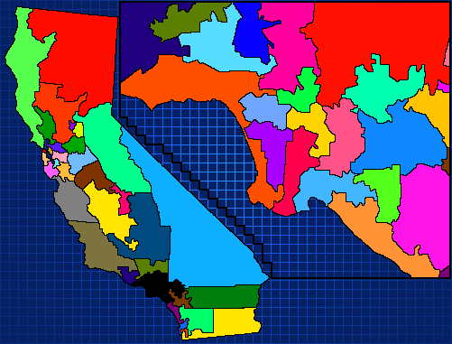
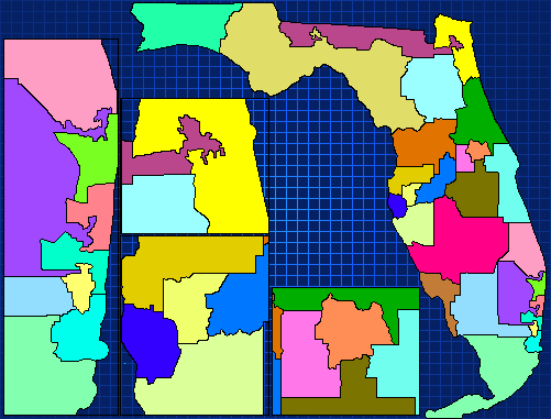
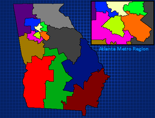
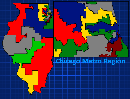
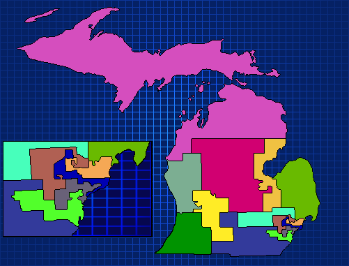
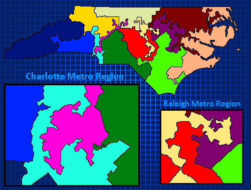
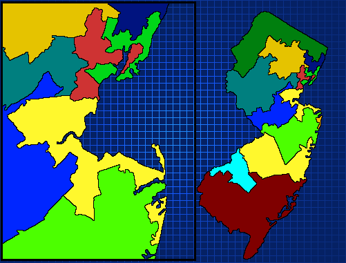
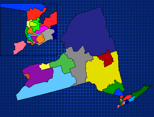
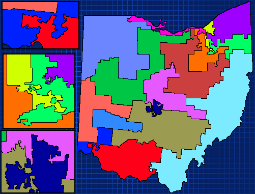
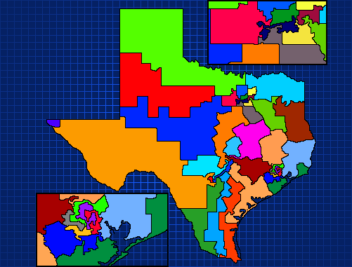
A few examples of the larger maps in this collection. Some are as old as 2021 (Florida, Michigan), and as new as 2026 (New Jersey, Illinois). The older maps will be updated in the attached file as time goes on, along with contents in the file.

Welcome to the 2013 – 2023 U.S. Congressional District Map Collection (Nov. 18, 2026 Edition), the comprehensive compilation of 45+ Congressional District Maps, composed in 501×381 pixel resolution!

Each map – besides the several Statewide District maps and the Michigan Congressional District Map (District Wide),are (mostly) faithful recreations of the 2013 – 2023 maps of the provided states. These can be used for state-level U.S. House Congressional Elections (to do a hype-focused campaign), or, for funsies, a Gubernatorial or Senate election through a different lens!

A Couple Notations

Like stated above, there are two known missing Congressional State-Level Maps: the 2015-2020 NC Redistricted map and the2017 redistricted Virginia map. However, due to some other oddities in the state-to-state fight over “fairer” maps (there is always an argument either way), this number could be as high as 7. Further research must be done to determine the amount.

In this vein of discussion, the reason this series took so long to complete was multi-facated – but one reason was the bad map origins of some of the maps, particularly New York, FLorida, Ohio, and Pennsylvania. All maps, with the exception of several, came from Wikipedia’s pages on State Congressional Maps. Some of these, like the Texas and Georgia maps, were good base maps. Clean lines, obvious districts, helpful insets. Other maps, like the Redistricted NC and VA maps, the Ohio map, and the New York map, were not great sources. While a tracing problem is as aeasy as figuring out what is where and placing a line down, some of these are harder to see at a 501×381 scale. Some of them, however – due to bad sourcing – will take longer to tackle.

Second, the two Congressional District-level maps from Michigan. If you’ve followed me on X, this platform, Discord, or other platforms, you know my primary interest used to be Michigan Elections. The 2013-2023 maps for Districts11 (West Oakland County+ Northwest Wayne County) and 08 (Ingham, Livingston Counties + Northern Oakland County) were intially drawn to be semi-safe for Republicans, but both flipped in the 2018 midterms, and stayed Democrat in the 2020 election – when the Democratic majority in the House was brought to it’s closest margin.

The districts themselves are incredibly interesting cartographically. For those not in the know, Michigan has two levels of political carographic breakdowns – Counties and Cities. Some counties, like Michigan’s 1st (covering the entirety of the Upper Peninsula and a good chunk of the northern part of the Mitten) work better in a County-level map (due to the fact that Cities would give you a hundred little dots on the map). However, Michigan’s 9th District (the ol’ Warren-South Macomb + Oakland District) work beautifully as Cities maps.

Thus, I wanted to create the Cities maps for these two congresional districts. If you are so inclined, you can make campaigns in Congress Infinity/Prime Minister Infinity -Classic for the 2014/16/18/20 Congressional elections – where 2 will be GOP-friendly, and 2 will be Democrat-friendly.

Lastly, there are several state-level maps. Famously, up until 2022, Montana only had 1 Congressional District (in our modern era). States like it, Alaska, the Dakotas, Nebraska, Vermont, and Delaware thus have been provided via County maps; these maps come from outside sources that are not me, so understand that those were drawn by other users and downloaded for my use.

One last, amazing note: Because the MI-08 and MI-11 maps are focused on a singular Congressional District, they technically qualify to be maps for President Infinity scenarios! Fun fact: in Summer 2022, I worked on, for a time, an unfinished MI-08 2018 scenario – that’s why I feel it’s important to mention that fact. If you do feel so inclined, the information for population data, voter data, and other local information has been made even easier in our modern digital age of A.AI. and open-source data gurus. So have fun!

WithThat…

The future plans for this downloadable link will be as follows:

  • Add “Reference Maps”: Each map had a reference map it was used to create from; these provide information like district numbers and sources used.
  • Upadte Maps: In the 2026 Completionist Run of finishing up this series, I started adding things like Inset Names to the maps. These did not exist on earlier maps, where insets were focused on being large enough to see clearly over where the inset was focusing on. That is aimed to be fixed.
  • Expansion: As discussed, there are many, many opportunities for expanding this file. There are other City/County-level versions of the districts across the nation, and more importantly – there are other maps that need to be made and added to the file.

I hope to see you in the commnets. If you feel so inclined, please let me know your favorite map. In other requests, follow me on X at https://x.com/BlindManSaS, and at YouTube at https://www.youtube.com/@BlindManGamingRebirth. I also use the sister channel “Blind Man: Systems and Stories”, but BMG is my main account right now.

I look forward to hearing from anyone who found this helpful or interesting! Thank you for reading and supporting this site with your viewership!

Michigan + Wisconsin County Maps – Made for PI 2020!

I was tired of the old style of map, and wanted to create my own. Since the editor doesn’t support targeted selection yet, you can only upload it as the map. But you can still just put it in if you want.

This is a predecessor for a new series I’m working on. The only states I’ve completed so far is Wisconsin and Michigan, so if anyone wants to create more, let me know!

Congressional District Map Series Files – MICHIGAN (1970s-2010s)

This is it! The moment (some) of you (probably) have been waiting for! This is a file which contains all U.S. House maps for Michigan for each Decade of the last 5 decades (1970s, 80s, 90s, 2000s, 2010s).

Using the maps from Wikipedia, I hand-drew each map-in some cases the state is stretched, and in others it stays as true to it’s original shape as I can get it, but all maps are dutifully re-drawn to allow you to pop them in and use them in your very own Single State series! To anyone who asks me, no I do not intend to have the California map out soon. This is the biggest thing I’ve done since trying to do the scenario for Florida-which got deleted (sad).

Next state to get this treatment may either be West Virginia or Wisconsin, maybe even Arizona! Who knows? See you in the comments!

Template – Michigan

Hello everyone! It is I, your dear ruler, back from isolation where I have been slaving away for things to be made available to you, my loyal plebs!

In my time away I have literally attempted to create a Michigan 2020 Senate scenario for you (and myself) to enjoy. In doing this, I discovered there is one immense problem. Michigan is a state of 83 counties, with 70+ of those being normally very conservative. Going through and 1) naming, 2) targeting, 3) inserting a) voters, b) population, and c) voter registered, 4) region IDs, and 5) county flags alone takes almost an entire day. One problem most scenario creators find is that it’s nigh impossible to stay dedicated to such work over an extended period of time (I can’t imagine the slog that must be doing a state like Texas, with over 200 counties.

I do not know yet if anyone has made a Michigan scenario, I do not believe so. So in this case I decided to make a template.

This has everything already set out for you-voters, reg. voters, population, region names, ids, and flags, region placements, default R-D candidate placeholders, all the basic work is done already. You need to add in everything else-issues you want, candidate’s names and other things, blurbs, issue strength, events, debates, polls, primary info, that sort of stuff. But, all the hard work, the really hard work-is done for you. So please, enjoy!

Note: I am currently creating a Michigan Senatorial 2020 scenario, and so would appreciate it if no one else took up the challenge of making it!

New Mexico – US House – 2018 (Single State Series)

I have yet again returned, my friends and loyal subjects! I have brought with me gifts, and tidings of great joy!

In this installment of Single State Series…New Mexico, in the recent 2018 Congressional Election!

What’s New

-Smaller Targetable Area: With only 3 congressional districts, it shouldn’t be hard to attempt a sweep from either side. However, be forwarned: Like IA-02 and IA-04, all of New Mexico’s House seats are considered Safe (either way) at the beginning of the scenario. HOWEVER, in my testing, I did somehow flip a district which was D+9% by the time of the Election, so I have no idea.

-Smaller Amounts of Money!!: I finally figured how to make you start off with a smaller amount of money! I shrunk allowances for all main parties to 25k and thus you start with only 50k. Background fundraising at the max is about 30k per turn if you refuse to use any CPs. But if you do try to spam TV ads, keep them below 20k per budget-it’ll drain you fast if you’re not careful.

-New Map!: Of course, why else even download it?!

Future Plans

In the coming future I want to get out both Nebraska, Tennessee, Arkansas, Kansas, Oklahoma, and other small states from either 2016 or 2018-whichever comes easiest.

If you have issues or suggestions, please leave them in the Comments, and let me know how your playthrough went!

Iowa – US House – 2016 (Single State Series)

Hello, player! Ever wanted to play or watch the 2016 House elections? Of course you do/would, why else would you be viewing this post? Well anyway, ever find yourself wondering what it would be like to just play the House in one state? The all 435 races in normal Congress Infinity giving you anxiety? Have no fear, general viewer! Behold, the brand new Single State Series, for the US House!

In this series, one takes control of a specific party in a specific state. This smaller focus allows one to more easily focus on the really competitive (or in certain races, the least competitive) races, without worrying if you’ll lose the lead in a district literally anywhere else in the states.

What Changed?

-New Map (obviously): Iowa US House Congressional Districts, 2013-2023

-Observer Mode/Party!: I love it,?you love it, heck for all scenarios official and custom, it should be mandatory!

-New region-specific photos!: Taken from here, “Current Districts and Representatives”

-Adjusted population for each region, voters, and possible voting pop:Found from here

-Added massive amount of “Historical Context” for the General Blurb, for thos interested in learning

-Two start dates! October 8, and September 1, per request

-Re-adjusted Surrogates for the scenario. If you feel there could be a better scenario with more surrogates, please let me know!

-(V1.1): Lowered “Allowance” (my word for party campaign funds) has been lowered to 300k for both main parties, thank you to who suggested it, you know who you are.

Future Plans/Few Last Things

n this specific scenario, Iowa -2016! Iowa’s 2016 campaign wasn’t the most competitive in real life-all of the electoral victors won by at least 5 points. However, I felt it would be helpful for you to start on an easier (in the GOP mind) campaign, or for the Democrats, an extermely hard campaign. In the future, I hope to create and upload both the 2014 and 2018 races as well.

This is my very first campaign to go public for 270soft-I’d be incredibly grateful for any and all feedback from you. If you feel there are improvements to be made, please let me know and I’ll do my best to accomodate, and hopefully make it better.

Again, I’ll repeat myself. This is meant to be the launch of a series. I hope to make more scenarios like this in the future.